Thursday, October 25, 2012

Notes on the Gaiety Hill Name and Significant Families

One of the minor mysteries of Salem is the origin of "Gaiety Hill." The Gaiety Hill Bush's Pasture Park Historic District (126pp pdf) goes on and on, Gaiety Hill this and Gaiety Hill that. But it never says how it got the name!

Nobody seems to know.  Writing over at SHINE, principally about the Smith-Fry house of 1859, Virginia Green says the neighborhood "gained a new name, Gaiety Hill" in 1909, but not how or why. In her note on 1907 she observes it had been known as Rattlesnake hill. Elsewhere in many other sources, Fry Hill rattles around. 

ES Glover's Birdseye Map of Salem, 1876
Library of Congress (Click to Enlarge)
The origins of Gaiety Hill are so unclear, that we - and several others in conversation and email - have wondered if it was just made up in the 20th century as a way to "romance" a micro-neighborhood that wanted a more elegant or sexy identity. What do you think of when you hear "Gaiety Hill"?  Gay 90s and parties of course!

Gaiety Hill in Willamette Farmer, July 1875
It turns out to have a history clearly sign-posted, if not perhaps very well documented.  We still aren't sure about its origin, but it appears to go back at least as far as the middle 1870s - several decades earlier than 1909.  And far from alluding to scandal, or having an unexpected or counter-intuitive association, it appears to mean exactly what it looks like. 

Piety Hill in Willamette Farmer, May 1874
It may well have arisen, as some have conjectured, in tandem with (and perhaps opposition to) the Piety Hill neighborhood. One was sober and upright, the other gay and rakeish? Outside of this, the story may not be all that exciting.

A snapshot of Salem society
A social history of Gaiety Hill is beyond our scope just now, but some definite details can be sketched out.   The neighborhood name appears most often in what we might call "society" notes - and in the early 1900s appears regularly on the named society page. Here is an early society note from June, 1888:
Party on Gaiety Hill.
Last evening, Miss Edith Hughes entertained a number of friends at the residence of her father, John Hughes, on Gaiety Hill, in honor of Misses Clara and Agnes Earhart, of Portland, who are visiting in this city.  Dancing was the order of the evening, and an excellent time is reported.
Two of the three families most often named in regards to Gaiety Hill are mentioned here.  On the map at top you can see the location of the Hughes residence and the Edes residence.  John Hughes had married Emma Pringle, and the family was of some standing.  Daughter Lulu married into the Bush family.

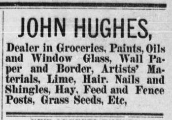
Hair, Lime, Artists' Materials
The Hughes home stood where the Jarman house is today and was demolished for its construction.  Green suggests an Italianate home was built there in 1907, but if so, it replaced a residence already there.  Polk Directories show John Hughes at the corner of Oak and High from at least 1893 and continuing through the address change - from 47 High Street to 567 High Street.  Sanborn maps also show the house in 1895.  The 1905 birdseye map also shows a four-square Italianate in the right location. We are doubtful that a new house was built in 1907, and suspect rather that the address change of 1904/5 is causing confusion.

Hughes' obituary has perhaps a clue about gaiety and piety: "He was not a member of any church, but his sympathies were with Methodism, and he had always affiliated with the First M. E. church in this city, being one of its staunchest supporters."  Dancing, it should be noted, may still have been problematic for regular Methodists!

Edes (Smith-Fry) House, Marion & Linn County Atlas, 1878
The Edes house still stands, fortunately.  It is now known as the Smith-Fry house. About it the National Register nomination says:
The Smith-Fry House, on the top of Gaiety Hill, was built in 1859. It is the earliest constructed building in the historic district. This house, originally in the rural gothic style, is one of the oldest houses on its original site within the Salem city plat. The house was built by Joseph Showalter Smith, who lived in the house from 1860 to 1868. Smith was a lawyer who became president of the Willamette Woolen Mill in 1865. Smith was also one of the incorporators of the Oregon Central Railroad (1867), which was a contender for the grant to construct a railroad to San Francisco. This house at the top of Gaiety Hill was a center of capital city politics and social life for many years. After Smith, the house belonged to Lafayette Grover, a Congressman, Governor of Oregon (1870-77), and U.S. Senator (1877-83). Other owners include George Edes, Sheriff, County Clerk and Mayor; and Daniel Fry, Secretary of the State Board of Control during the Great Depression and early war years. Gaiety Hill has also been called Fry Hill and Edes Hill because of owners of this property.
Others at the party include members of the Dalrymple, Albert, Westacott, and McNary families.  Myra Albert became Myra Albert Wiggins, and for a brief period around 1905 even lived in the Smith-Fry house with her husband Frederick Arthur Wiggins!

Jones Advertising, 1890
The other name that appears often in pieces about Gaiety Hill is Jones, and the Jones mansion.   George H. Jones was an early merchant and developer.  From his obituary:
Mr. Jones came to Oregon first in 1852, following the weary trail across the plains, as did many others at that time. He returned to the East via the Isthmus of Panama in 1854, but again in 1855 came back to Oregon and formed a partnership with the late Hon. E. N. Cooke, they having for eight or ten years the principal merchandising business of Salem in what was known as the Headquarters building, which then stood on the present site of Ladd & Bush’s bank, on the corner of State and Commercial streets. They furnished a great deal of merchandise and other supplies to the soldiers during the Indian war of 1855, part of which was never paid for. Mr. Jones opened a financial agency upstairs in the same building and dealt heavily in government script. Mr. Jones also brought a large drove of cattle through from California in the early days, and had a hard time getting through Southern Oregon.... He was married five times, and his fifth wife survives him.
Jones was a son-in-law of David Leslie, and the according to the Historic District nomination, the "George H. Jones Addition or Subdivision, located west of the Bush property [was] part of the original David Leslie DLC... [and] platted in 1865."

Many toilets were becoming!
On Oak between Liberty and Commercial, basically where the library is today, the Jones mansion appears to be the grandest house on Gaiety Hill, and you can see it dominates a whole block on the map in 1876.  There is in a couple of places some ambiguous question whether it burned down and was rebuilt.  But this is not clear, and the house appears also on the 1905 birdseye map, equally dominating and grand.

In December of 1874, the Willamette Farmer described "A Social Event" at the Jones' on "Gaity Hill":
One of the most hospitable mansions in Salem is the house of the seven gables, on the hill across South Mill Creek...It was really a dress parade of Salem gallantry and beauty, and many toilets, without being extravagant or too fashionable for real taste, were quite elegant and becoming. The evening passed away without restraint.
Sounds like a party!

Finally, in one tantalizing hint, the obituary notices for Harriet Clarke, wife of S.A. Clarke mention that "For years she was the life and ornament of society in Salem, and their pleasant home was a synonym for hospitality and gave the name to the hid [?] that it now bears." This should probably read "gave the name to the hill that it now bears."  S. A. Clark was many things, railroad shareholder and organizer, editor and owner of the Statesman between 1869-72, fruit farmer, and author.  During his time at the Statesman and at least until Harriet died in 1890, he maintained a house on Commercial and Oak, kitty-corner to the Jones mansion.  It is possible that the Clarkes house was named Gaiety and also contributed to the naming.  (Clarke also seems to have lived in Portland, Washington DC, and maintained a house on the Candalaria Fruit Farm.)

One reason that Gaiety Hill's origin may have been lost is that the Civic Center took out the center of the district.  But even by 1926 the Sanborn map shows the Clarke and Jones houses gone, and the Hughes house would disappear just a couple of years later for the Jarman house.  While today we might think of Gaiety Hill as centered on the intersection of Oak and High, the site of the Jarman, Pearce, and Smith-Fry houses, in the late 19th century its center seems to be a couple blocks west, on Commercial, where the Jones and Clarke houses were.   We will have to learn more about when the Jones mansion was demolished, apparently in the 19-teens or twenties.

And while we would not want to read too much into the obituaries of Hughes and Jones, it is interesting that one was not a member of a church, the other was married five times.   It is plausible to look for more evidence that those who lived on the hill may not have been especially reverent and enjoyed lifestyles that may indeed have posed a contrast with those who wished to live nearer the churches in Salem!  That the 1874 Jones party went off "without restraint," hints at this also, as does what may be an allusion to Nathaniel Hawthorne's book

It is an interesting question how Salem's prominent and rising families sorted themselves, some to Piety Hill, some to Gaiety Hill, and some perhaps to other neighborhoods.  For example, Jones' partner Cooke built on Piety Hill.  Does this say anything about Cooke and Jones?

In the end we were all ready for a revisionist history of Gaiety Hill with scandal and vice, but it looks like everyday social climbing with just a touch of the rake.

Saturday, October 20, 2012

Hillsboro Hops were Salem Senators! - More on Minor League Baseball and Knighton

Well, golly! A reader sends along a note that the Hillsboro Hops go back in descent to the Salem Senators!

The chain looks something like this:

Hillsboro Hops (2013- )
Yakima Bears (1990-2012)
Salem Dodgers (1988-89)
Salem Angels (1982-87)
Salem Senators (1977-81)
Salem Dodgers (1961-65)
Salem Senators (1940-42, 1946-60)
Bellingham Chinooks (1938-39)
...
Sign at Waters Field, Salem Library Historic Photo Collection
Between 1940 and 1965, the Senators played at Waters Field. Waters Field was located on the Northeast corner of 25th and Mission, just about exactly where the main Post Office is located today.
Waters Field, 25th & Mission from 1950 Sanborn Map
current site of Post Office
George Waters, circa 1940
George Waters sold cigars and tobacco. According to the City's history of the Durbin Building, located on the northeast corner of State and Commercial,
George E. Waters, a native of Nebraska, born in 1869, came to Salem, Oregon, with his parents in 1872. In 1891 he opened a cigar store in Salem. Fifteen years later, he embarked on the tobacco wholesale business in his shop on State Street. He eventually added wholesale candy to the inventory of his tobacco shop on State Street....Joseph Adolph [brother of Sam Adolph!] and George E. Waters both purchased an interest in the corner Durbin Building in 1911.
About the first season, Capi Lynn wrote in 1996
A ticket was a quarter; scorecards and hot dogs were a nickel apiece.

For 35 cents, one could enjoy an evening at the ballpark.

Players were paid about $130 a month, and they traveled from game to game in a rickety old bus.

Those were the vital statistics of professional baseball in Salem, as it was in 1940.

George E. Waters, a man who made his money selling wholesale tobacco and candy, was the father.
Leila Waters, OSL
He purchased a Class B minor league franchise from Bellingham, Wash., brought it to Salem, and built a $60,000 stadium for it to call home. It was his home, Waters Field.
Salem was a small town, and the connections go ever deeper.

For George Waters was William C. Knighton's brother-in-law! Knighton had married George's sister, Leila Waters (also Lella Waters in some sources), in Indianapolis in October 1898.

And, in fact, the Knighton designed a house at Summer and Center for George around 1911. (The National Register listing for the Schnabel House in Portland says 1895, but this seems unlikely, as this would make it a near-contemporary of Deepwood and the Murphy house,* and obviously the style is quite different.)

Waters House, Pacific Coast Architect June 1912, via UO Library
In Virginia Green's slides on the history of the destruction of Piety Hill you can see location of the Waters house on the southeast corner of Summer and Center. Today it's just greenery on the Mall.

Knighton and Howell, the firm that designed North High School, also may have done design work for the seating at Waters Field - but this was after Knighton died in 1938.

* The photo captions identify the Murphy house as being from the early 1880s, but this is clearly wrong.  The National Register listing for the Hamilton House in Roseburg identifies Murphy as a Knighton client, and the Hamilton, Murphy, and Port/Deepwood houses share a family look. This announcement from July 3rd, 1894 is strong evidence this house, and not the Waters house, was completed about 1895.

Wednesday, October 17, 2012

Knighton's Supreme Court building to be Nominated?

W.C. Knighton Drawing, UO Library
and Pacific Coast Architect, May 1912


On February 27th, 1914, the Oregon Supreme Court building was dedicated. It's the oldest building on the Capitol Mall.

In time for its 100th anniversary, it looks like it may be nominated to the National Register of Historic Places!

Tomorrow night at the Historic Landmarks Commission, Commissioners will hear and discuss prospects for a nomination.

The building, designed by William C. Knighton, is almost certainly the most distinguished in Salem not yet in an historic district or with its own listing. This is actually something of an oversight, and we are hopeful for the correction!

(For our Knighton notes see here.  SHINE has a photo taken from the old Capitol during construction.)

Maybe this will also draw more attention to the years just before the first World War.  Several important commercial and institutional buildings were planned and constructed during this period:  The Dome Building (Recieving Ward) at the State Hospital, the Masonic Building, the Boise Building, the Hubbard Building, the Carnegie Library - and the Union Street Railroad Bridge.  Homes, too, like the Cusick house and lots of others we don't know about.  It seems like Salem enjoyed prosperity and a building boom in the early 19-teens, and more on this would be welcome. 

Library, Pacific Coast Architect, Jan 1913

Tuesday, October 16, 2012

Hops new Minor League Baseball Team

Love Love Love this.

This is making the rounds, and is already old news.  From the Oregonian:
In a release, general manager K.L. Wombacher said the franchise elected to go with a name that had never been used in professional baseball because of its importance to the region. “The name 'Hops' recognizes Hillsboro’s proud agricultural heritage and the fact that Oregon is the second largest hop producing state in the United States,” Wombacher said.

The name also has ties to quirks of the game itself, Wombacher said; think short hops and bad hops to name a few.
Objections seem to come from Temperance Ninnies and from wags who (correctly) observe that hops are grown in Marion and Polk counties, but not in Washington county.  Sour Grapes!  Details, smeetails!  Craftbrewing carpetbaggers can jump on the beer bandwagon any day!  As they say of double plays, "nicely turned!"

(Are any of Oregon's breweries big enough to afford stadium naming rights?)

Saturday, October 13, 2012

Raen Brew, Pringle Creek, Beer History - Odds and Ends for a Rainy Day

Rain, Rain, Go Away! 

The change in weather makes us hunker down  - and think about water, falling from the sky or transformed into beer!  Here's some odds and ends...

Right by Santiam Brewery is a new beer supply house and tasting room, Raen Brew Brewporium. (It's not difficult to see why we think of it just now!)

We aren't sure we entirely understand the tasting room business - a couple of taps as an amenity to supplement a home-brew supply business would make sense, but they are clearly making a bigger play for a more substantial pub business, and for this their lack of evening hours seems like it could be a problem. Hopefully things will work out!

You can see the taplist here.

Doubling up with a visit to Santiam and Raen Brew - and with Gilgamesh not far - could make for a very pleasant urban beer experience. Just have a designated driver!

The Oregon Beer Growler has an article of interest!

Readers here will find little that is new (and we would quibble with a few details - the caption on the photo, for example, is wrong), but it's nice to see the information get wider play. 

Finally, on the blog of Mission Mill, commenter Ann raises questions about naming the stream we now call Pringle Creek.  With mills, it's not surprising older sources call it "South Mill Creek" instead.  Here's an ad from April 1910 that shows a Pringle Creek distinct from Mill Creek.  Another reference from a couple of years later mentions motoring out to Pringle Creek for a picnic. 

When urban trout fishing was possible
And, in fact,on the 1852 survey map you can see a creek running through the Pringle land claim. On the surface, this appears to have a strong claim to being the first "Pringle Creek."
1852 survey detail, University of Oregon
Note the Jorys and Battle Creek. This is out south! And it would have been a fine place for a picnic.

The swampy area where Battle Creek and the feeder creek, now ditched and tamed, flow together is almost certainly the site of the old golf course that has been in the news the last couple of years for stormwater retention.

Detail from Pringle Creek Watershed Map
The City's history of Pringle Creek, however, may miss this and says
The reference Oregon Geographic Names, on page 690 states that Pringle Creek was named after Virgil K. Pringle, who arrived in Salem December 25, 1846. He took a donation land claim near the stream which accordingly he named for himself. This stream rises in the hills south of Salem, and flows through the southern part of the town. The other adjoining buildings and features in the area accordingly took the name of the creek in their names as well, such as Pringle Park Plaza.
We believe part of this is correct, that Pringle named a creek. But we think the creek he named feeds into Battle Creek, and that some time in the early 20th century, the term "Pringle Creek" was shifted to a different creek, one that had been confusingly named "South Mill Creek." In order to make it distinct from "North Mill Creek," which we just simply call Mill Creek, the southern "Mill Creek" was renamed "Pringle Creek." (Got it?!)

More research is in order!

Sunday, October 7, 2012

State Insurance Building: Not Lost, but Hidden and Hardly Recognizable

They call them "re-muddles," remodels so bad the resulting building is a random jumble, often super ugly.

You may recognize this building on the corner of Commercial and Chemeketa. It was offices for the Union Gospel Mission and at one time a record store.

Recently, RC pointed out a few interesting architectural details.

Here's a mysterious chimney poking out of what otherwise seemed to be a low-slung storefront from the 70s or 80s.

Underneath it was an arched window and maybe some cast iron detailing.

Both window and chimney suggested a building of some antiquity - at least by Salem standards.

State Insurance Building - Corner of Commercial and Chemeketa
Salem Library Historic Photo Collection
And sure enough, the window details and window placement matches those in some old photos.  Even the chimney's still in the same place.  (Here's a color image from 1954.)

It's the State Insurance building, once home to the YMCA! The remnant first floor, anyway.

We always thought this building had been leveled and lost.  Most sources are silent or suggest the authors consider the building demolished.*  Writing about the year 1891, Virginia Green says,
The YMCA moved out of the building in the following year [1906] and the building itself (the State Insurance Building) was demolished before 1948.
Though later, writing about 1946, she says "This venerable building lasted until at least 1981."

And it looks like it's still there! The upper two stories were just amputated and the storefront got a big awning.  It's almost totally unrecognizable. It might as well have been demolished.  No wonder there has been uncertainty and confusion.

(And in fact the whole block face got remuddled.)

The building's age seems uncertain, but it goes back longer than to 1891 (the State library has two 19th century images here). An ad for the Oregon Land Company from 1889 shows it as an established building. As Ann points out in a comment, the date on the central tower reads 1888.


In 1890 Bert Hoover attends
a wedding in Highland
Copy in other ads suggest the Oregon Land Company was in the State Insurance building at least as far back as 1888. The State Insurance Company seems to have been incorporated in early 1884, with newspaper advertising starting in April of that year. (We'll have to look around some more to see if we can find a building date!)

And there's more than a little bit of interesting history associated with the building.

Many others have noted that Herbert Hoover (1874 - 1964) worked for his uncle, Henry John Minthorn, at the Oregon Land Company in this building between 1888 and 1891.  (Apparently, everything Hoover touched in Salem has been ruined or remuddled.  His house during these years, the Minthorn house on Hazel in the Highland neighborhood, is also unrecognizable.) 

According to Ben Maxwell, the State Insurance building was also apparently the "downtown terminal" for the first horse-drawn streetcar on Commercial and State streets, connecting to the old Capitol. Additional track to the Fairgrounds and the Train depot followed shortly.

The Oregon Land Company was a principal investor in the streetcar, always seeking ways to improve land values farther from the center of Salem, and Hoover also worked occasionally as a streetcar conductor. According to the Maxwell compilation, by the late 1890s, the streetcar reached the Highland neighborhood, where Minthorn was very active in real estate.

Later it was home to Saffron Supply and a pawn shop, Star Exchange.

Without knowing more about the condition of the upper stories, it is not possible to say that the building should have been preserved.  Perhaps it was badly deteriorating.  Still, it would be nice for the first floor storefront system to be restored somewhat, the awnings removed, and some interpretive signage to remember this as part of the local Y's history as well as the trivia-question answers about Herbert Hoover's activities.   Maybe a new tenant will be interested in this.  We think there might be rehabilitation grants and loans available for this sort of thing.

In any case, we can say that the State Insurance Building remains, severely compromised and altered though it may be.

* These include the Arcadia Publishing picture book on historic Salem, the Statesman Journal's A Pictorial History of the Willamette Valley, Harry Stein's Salem: A Pictorial History of Oregon's Capital, and the City of Salem's Historic Salem: An Inventory of Historic Places (1987)

Confusion extends to the date and location of the first basketball game in Salem. Al Jones said that it was reported in the paper on a date the paper wasn't printed: But no Capital Journal was printed on Sunday, January 10th, 1892! A photo caption in his piece identifies the State Insurance building as the location, and this shows up in other sources, but a separate history of the Y says the YMCA didn't move into the building until 1901. This date is more believable because the State Insurance Company had gone under in the depression that followed the Panic of 1893, and much of the building would have been available.